What is Ixxy Earth?
At Ixxy, we specialise in harnessing the power of geospatial information services (GIS) to provide bespoke solutions tailored to fuel your organisation's growth. As experts in data science, we leverage technology to seamlessly process, analyse, and visualise geospatial data. Our advanced technology plays a pivotal role in facilitating informed decision-making, optimising resource management, fostering environmental conservation, and enhancing the overall quality of life in our increasingly interconnected and location-aware world.
Pioneers of Geospatial
Geospatial technology is continually evolving and finding new applications across various industries. Our team, as leaders in this space, leverages years of experience to further develop the boundaries of the digital frontier. With a relentless pursuit of innovation, we've charted new territories and set industry benchmarks. At Ixxy, we are not just keeping pace; we are defining the future of geospatial technology.
Here's just some of what we can do
- 3D Mapping - A new and innovative way to deliver visualisation of data, this allows a combination of augmented data streams to create a live 3D map. This map allows the end user to explore and realise outcomes for their chosen location and can be customised to maximise any project brief.
- Pathfinding and Distances - A dynamic way to deliver visualisation of data focusing on a key point and its associated information. This 2D map allows the end user to visualise data in relation to their personal circumstances based on a range of factors.
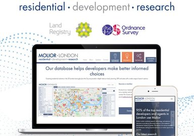
- Data Contouring & Heat Mapping - An effective way to deliver visualisation of data, contour visualisation utilises a combination of data streams and spatial linking to create a “heat map”. This allows the end user to digest data in an
effective visualisation and can be customised to maximise any project brief.
Why You Should Consider Ixxy Earth
- Gain operational advantage with geospatial analytics - Gain competitive edge by employing our cutting-edge technology to make data-driven decisions, streamline operations and maximise productivity.
- Optimise business processes for maximum efficiency - Unlock the potential for unparalleled efficiency. Streamline workflows, ensuring resources are where they're needed most, all while minimising costs.
- Transform complex data to audience friendly communications - translate intricate data into clear, compelling communications. Make data more accessible and actionable for your team members and your audience.
Ready to unlock the power of Ixxy Earth? We can offer you cutting-edge geospatial consultancy, exploring your requirements through discovery sessions, prototyping, data gathering and analysis, to deliver the highest quality visualisations and analysis for you and your audience.